


BISCUIT FLAT Voting District, Maricopa County, Arizona
About
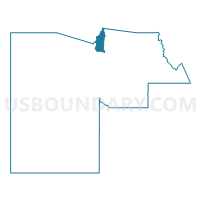
Outline

Summary
| Unique Area Identifier | 524878 |
| Name | BISCUIT FLAT Voting District |
| County | Maricopa County |
| State | Arizona |
| Area (square miles) | 73.73 |
| Land Area (square miles) | 73.44 |
| Water Area (square miles) | 0.29 |
| % of Land Area | 99.61 |
| % of Water Area | 0.39 |
| Latitude of the Internal Point | 33.89552660 |
| Longtitude of the Internal Point | -112.19073070 |
Maps


Graphs
Select a template below for downloading or customizing gragh for BISCUIT FLAT Voting District, Maricopa County, Arizona


Neighbors
Neighoring Voting District (by Name) Neighboring Voting District on the Map
- Canyon Voting District, Yavapai County, AZ
- Castle Hot Springs 1 Voting District, Yavapai County, AZ
- Castle Hot Springs 2 Voting District, Yavapai County, AZ
- DESERT SAGE Voting District, Maricopa County, AZ
- DOVE VALLEY Voting District, Maricopa County, AZ
- LAKE PLEASANT Voting District, Maricopa County, AZ
- NEW RIVER Voting District, Maricopa County, AZ
- PIONEER VILLAGE Voting District, Maricopa County, AZ
- SONORAN HILLS Voting District, Maricopa County, AZ
- TRAMONTO Voting District, Maricopa County, AZ
Top 10 Neighboring County Subdivision (by Population) Neighboring County Subdivision on the Map
Top 10 Neighboring Place (by Population) Neighboring Place on the Map
- Phoenix city, AZ (1,445,632)
- Peoria city, AZ (154,065)
- Anthem CDP, AZ (21,700)
- Black Canyon City CDP, AZ (2,837)
Top 10 Neighboring Elementary School District (by Population) Neighboring Elementary School District on the Map
Top 10 Neighboring Unified School District (by Population) Neighboring Unified School District on the Map
Top 10 Neighboring State Legislative District Lower Chamber (by Population) Neighboring State Legislative District Lower Chamber on the Map
Top 10 Neighboring State Legislative District Upper Chamber (by Population) Neighboring State Legislative District Upper Chamber on the Map
Top 10 Neighboring 111th Congressional District (by Population) Neighboring 111th Congressional District on the Map
- Congressional District 2, AZ (972,839)
- Congressional District 1, AZ (774,310)
- Congressional District 3, AZ (707,919)
Top 10 Neighboring Census Tract (by Population) Neighboring Census Tract on the Map
- Census Tract 6100, Maricopa County, AZ (7,044)
- Census Tract 6106, Maricopa County, AZ (5,546)
- Census Tract 6113, Maricopa County, AZ (4,659)
- Census Tract 14.02, Yavapai County, AZ (3,496)
- Census Tract 14.01, Yavapai County, AZ (2,500)
Top 10 Neighboring 5-Digit ZIP Code Tabulation Area (by Population) Neighboring 5-Digit ZIP Code Tabulation Area on the Map
- 85086, AZ (40,495)
- 85383, AZ (37,182)
- 85085, AZ (17,517)
- 85087, AZ (7,708)
- 85324, AZ (2,886)
- 85342, AZ (1,578)